Cartes
Source code on github.
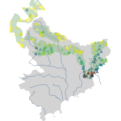


Cartes is a Python library providing facilities to produce meaningful maps.
Cartes builds on top of most common Python visualisation libraries (Matplotlib/Cartopy, Altair, ipyleaflet) and data manipulation libraries (Pandas, Geopandas) and provides mostly:
a comprehensive set of geographic projections, built on top of Cartopy and Altair/d3.js;
an interface to OpenstreetMap Nominatim and Overpass API. Result of requests are parsed in a convenient format for preprocessing and storing in standard formats;
beautiful default parameters for quality visualisations;
advanced caching facilities. Do not download twice the same content in the same day.
The cartes library is a powerful asset to publish clean, lightweight geographical datasets; and to produce decent geographical visualisations in few lines of code.